Tides, Weather & AI — In Your Pocket
Official tide data from the UK Hydrographic Office, NOAA, and more. Live wind & rain radar, AI-powered briefings, and smart safety alerts — everything you need for time on the water. Free to start.
Official tide data from the UK Hydrographic Office, NOAA, and more. Live wind & rain radar, AI-powered briefings, and smart safety alerts — everything you need for time on the water. Free to start.
Sailors, boaters, anglers, kayakers, surfers, and coastal walkers — TideWise gives you the data to plan with confidence
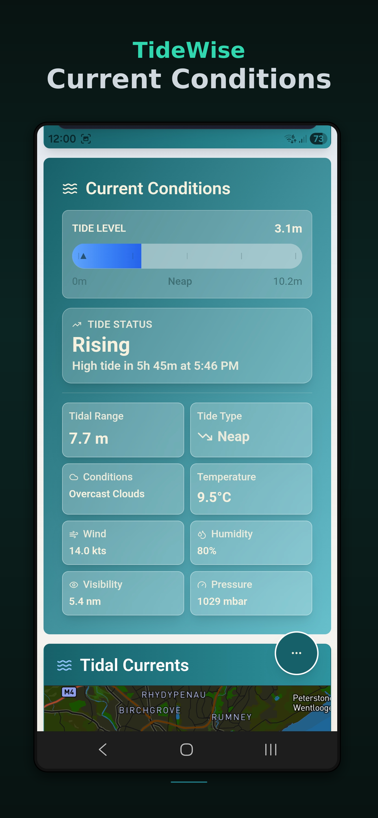
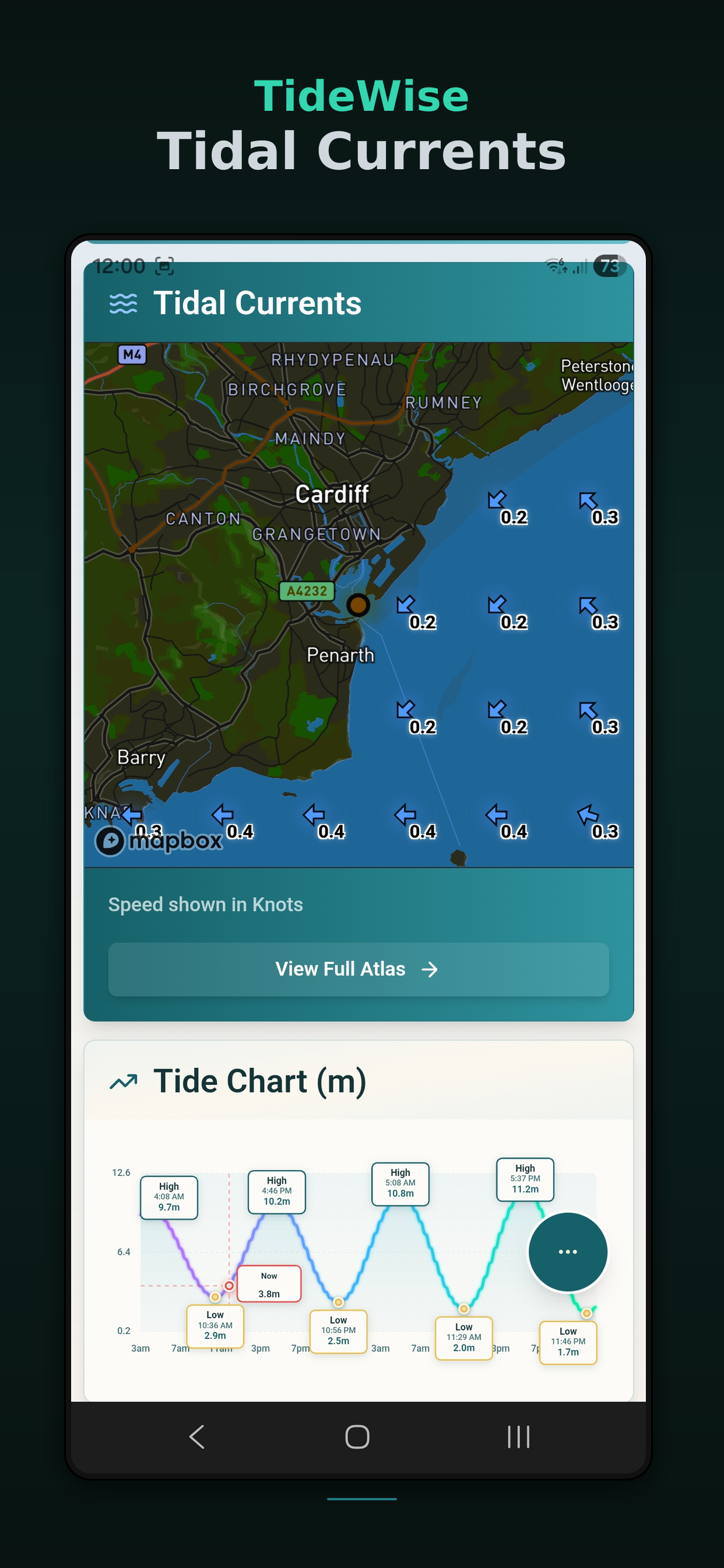
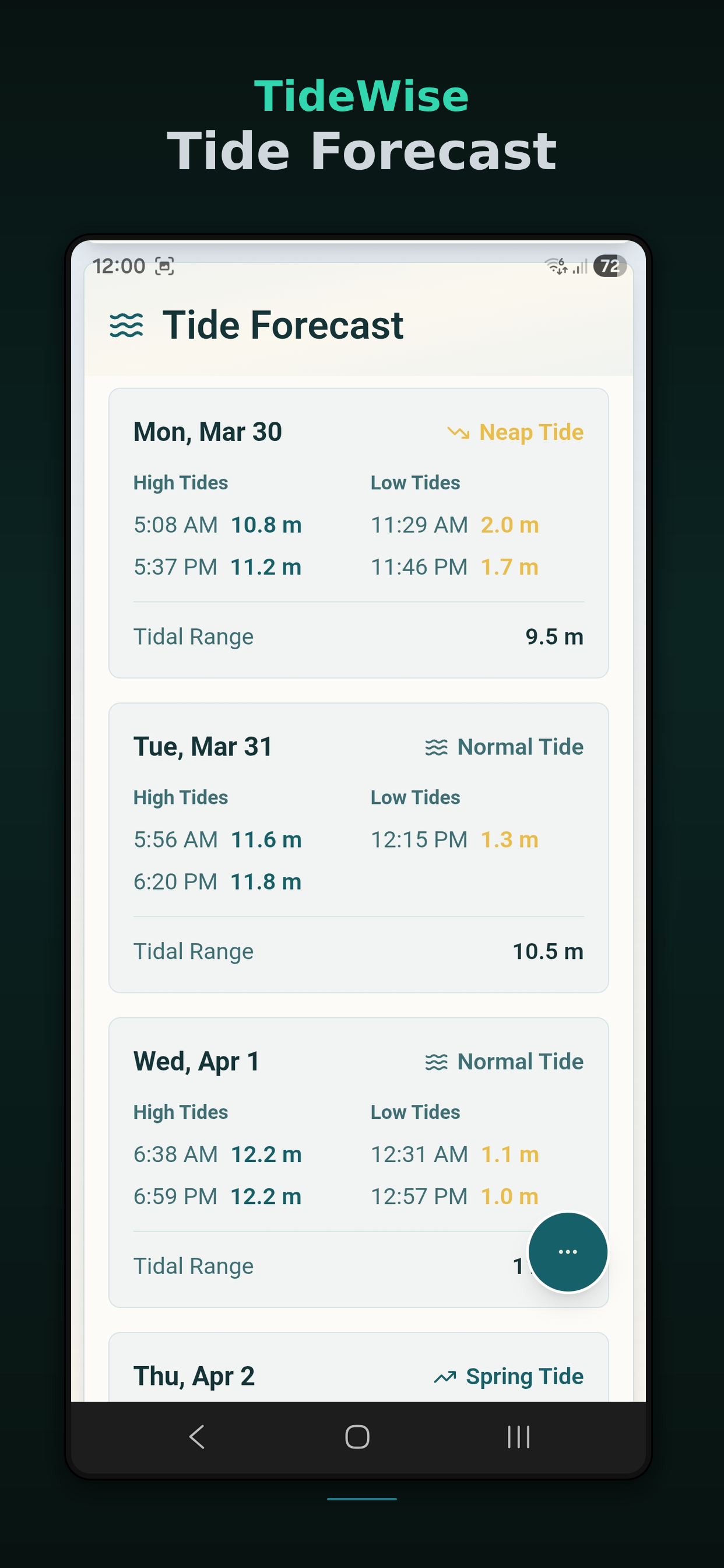
Accurate high and low tide times, heights, spring/neap indicators, and tidal ranges. Free tier includes today and tomorrow. Pro unlocks 7-day predictions with weekly trend views.
Real-time interactive maps showing current wind patterns and precipitation. See what's coming before you leave the harbour.
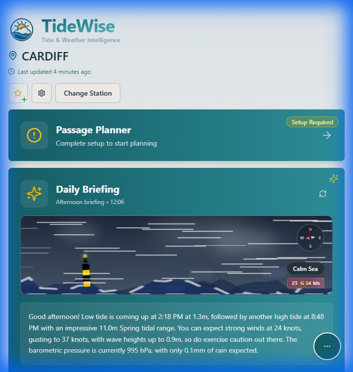
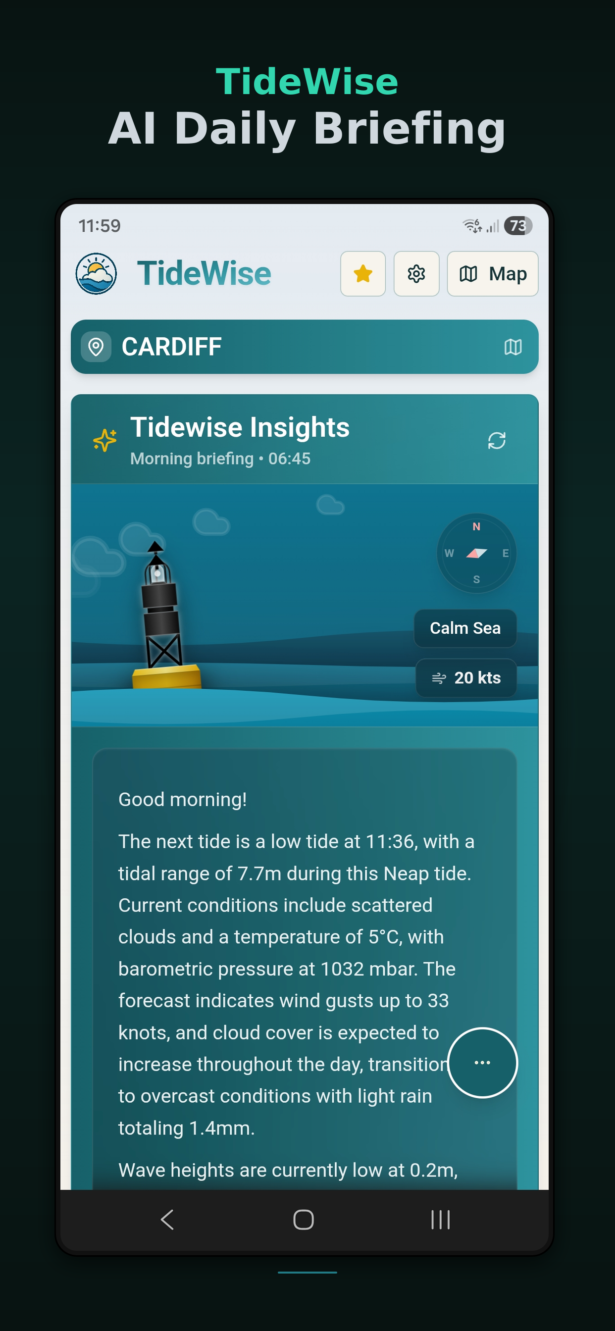
Plain-English summaries of today's conditions and the next 4 days. AI analyses tides, weather, sea state, and pressure trends so you don't have to.
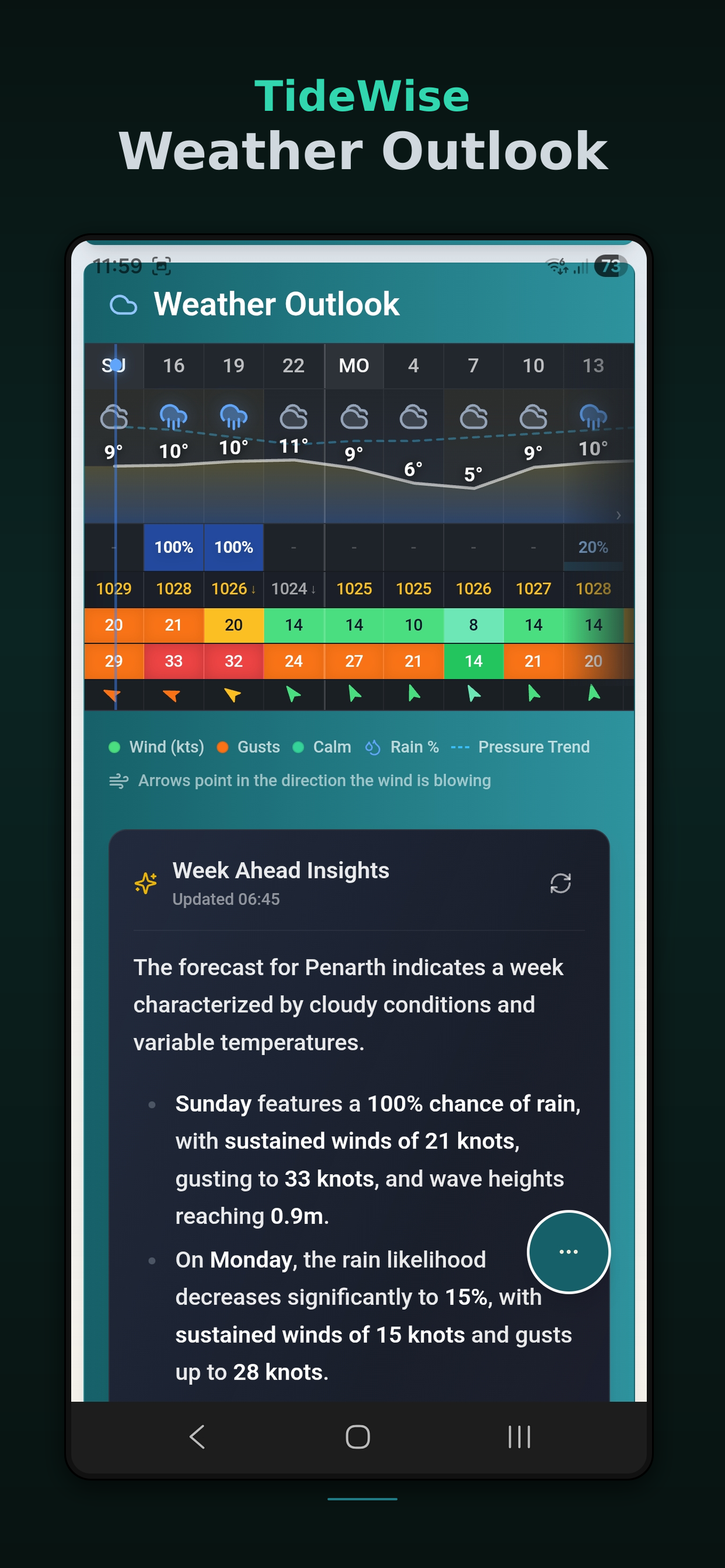
Scan the week ahead with AI-generated narratives. See at a glance which days are best for your plans.
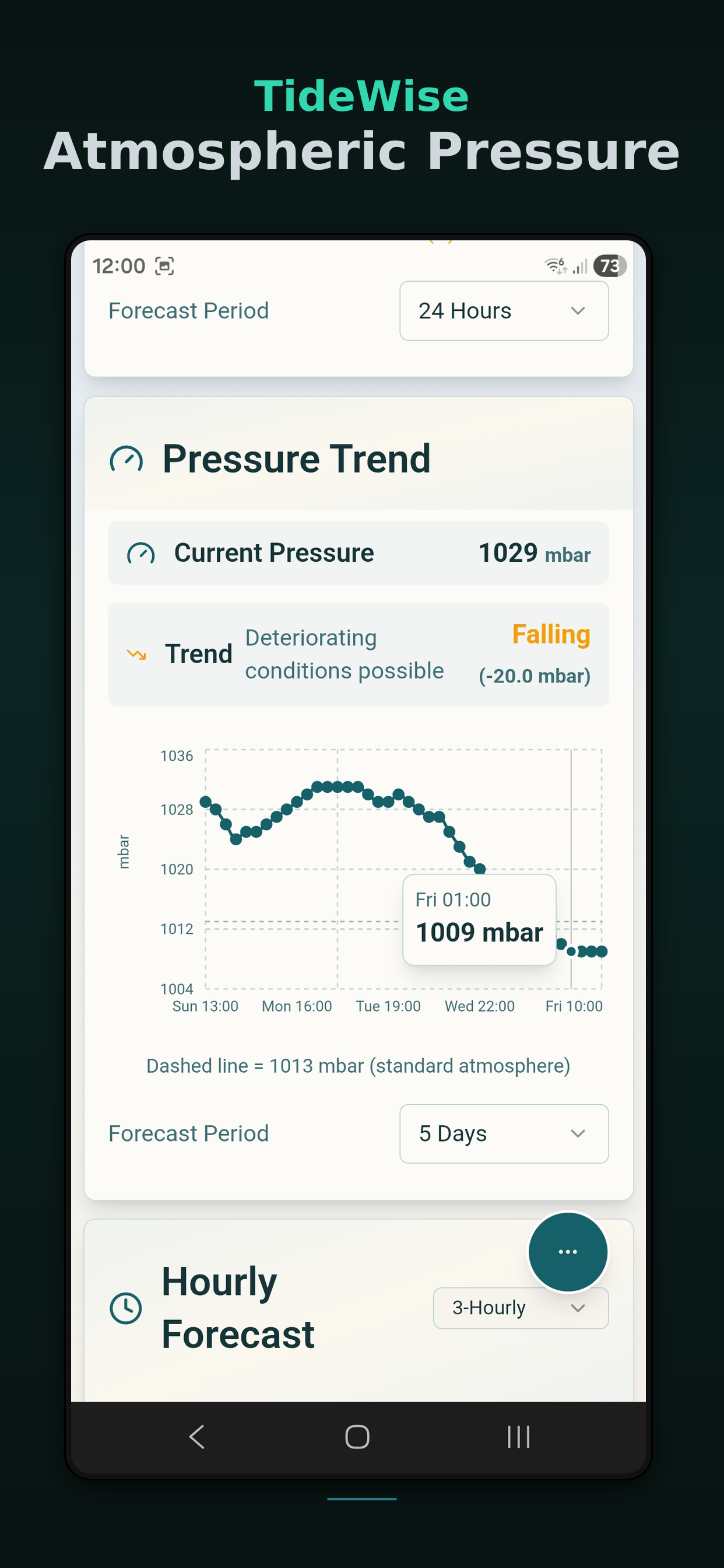
Wind speed, gusts, direction, visibility, pressure, temperature, and precipitation. Free tier includes current conditions and 24-hour forecast. Pro extends to hourly detail.
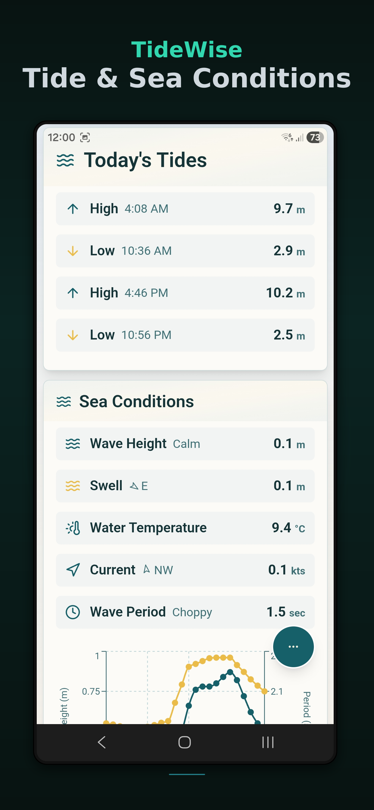
Animated sea state visualisations with wave height, swell direction, and wave period. Dynamic displays adapt to conditions and time of day.
Interactive tidal stream maps showing flow speed and direction. Plan passages with Admiralty-style current data.
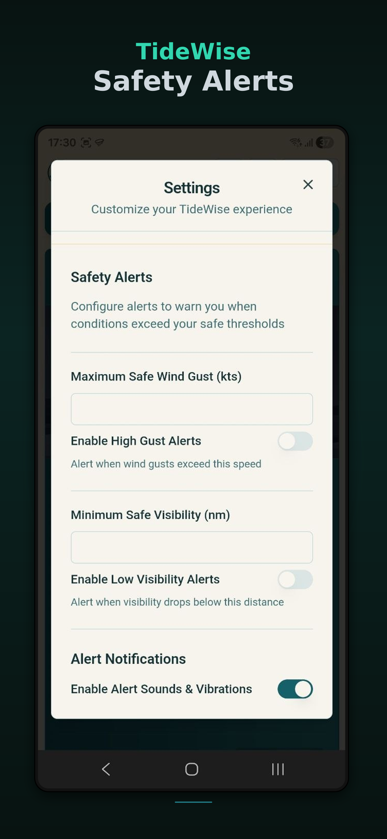
Set custom thresholds for wind gusts and visibility. Intelligent notifications only trigger when conditions genuinely change — no alert fatigue.
Official marine warnings and advisories for your location. Get notified of small craft advisories, gale warnings, and severe weather.
Tide predictions from the UK Hydrographic Office (UKHO), NOAA (US), and the Canadian Hydrographic Service. Weather from OpenWeatherMap. Sea conditions from StormGlass.
Premium glassmorphism interface with dynamic backgrounds that adapt to weather and time of day. Stunning tide charts and animated sea states make data beautiful.
Save your home port and frequently visited spots for instant access to the information you need most.
A premium nautical interface that makes marine data accessible and enjoyable

Free to start. Pro unlocks AI briefings, extended forecasts, and intelligent marine alerts.
TideWise was built by a sailor who knows the water. Frustrated by clunky tide apps that buried you in numbers without context, we created something better — a tool that explains what the conditions actually mean for your plans.
Our generous free tier includes real-time tides, weather, sea conditions, and live radar — everything most users need. Pro features like AI briefings and smart alerts are there when you're ready to go further.
TideWise uses official data from the UK Hydrographic Office, NOAA, and the Canadian Hydrographic Service. Whether you're planning a day sail in the Solent, fishing off Cornwall, kayaking in British Columbia, or surfing in Sydney — TideWise has you covered.